Remote Sensing & GIS Lab (RS & GIS Lab)
Incharge :
Dr. A. K. Handa (Principlal Scientist) & Suresh Ramanan S. (Scientist)
Lab associate’s :
Maneesh Yadav (Project Associate under NMSHE Project)
Ongoing project/activities :
Mapping of Jhansi Urban forestry
Major achievements :
a. Development of spectral Signature for various tree Species such as (Neem, Khejri, Poplar etc.), prepare agroforestry maps
b. Agroforestry area of entire country has been estimated.
c. Species specific agroforestry area has been estimated.
Publications :
a. Rizvi, R. H., Vishnu, R., Handa, A. K., Ramanan, S., Yadav, M., Mehdi, A., … & Qaisar, N. (2021). Mapping of agroforestry systems and Salix species in Western Himalaya agroclimatic zone of India. Current Science (00113891), 121(10).
b. Kumar, D., Rizvi, R. H., Bhatt, S., Singh, R., & Chaturvedi, O. P. (2021). Land use/land cover change and soil fertility mapping using GIS and remote sensing: A case study of Parasai-Sindh watershed in Bundelkhand region of central India. Range Management and Agroforestry, 42(1), 15-21.
c. Rizvi, R. H., Handa, A. K., Sridhar, K. B., Singh, R. K., Dhyani, S. K., Rizvi, J., & Dongre, G. (2020). Spatial analysis of area and carbon stocks under Populus deltoides based agroforestry systems in Punjab and Haryana states of Indo-Gangetic Plains. Agroforestry Systems, 94(6), 2185-2197.
d. Rizvi, R. H., Handa, A. K., Sridhar, K. B., Singh, R. K., Dhyani, S. K., Rizvi, J., & Dongre, G. (2020). Spatial analysis of area and carbon stocks under Populus deltoides based agroforestry systems in Punjab and Haryana states of Indo-Gangetic Plains. Agroforestry Systems, 94(6), 2185-2197
e. Rizvi, R. H., Newaj, R., Srivastava, S., & Yadav, M. (2019). Mapping trees on farmlands using Obia method and high resolution satellite data: a case study of Koraput District, Odisha. The International Archives of Photogrammetry, Remote Sensing and Spatial Information Sciences, 42, 617-621.
f. Rizvi, R. H., Newaj, R., Chaturvedi, O. P., Prasad, R., Alam, B., Handa, A. K., … & Chaturvedi, M. (2017). Mitigating climate vagaries through adoption of agroforestry land use in Maharashtra, India.
g. Arunachalam, A., Rizvi, R. H., Handa, A. K., S. Suresh Ramanan (2022).Agroforestry in India: area estimates and methods. Current Science, 123(6), 743-744
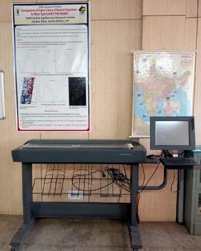
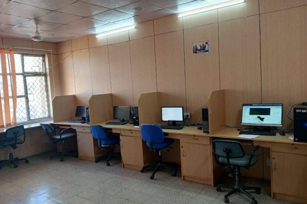
Remote Sensing GIS Lab Photographs
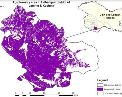
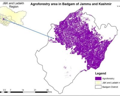
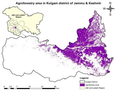
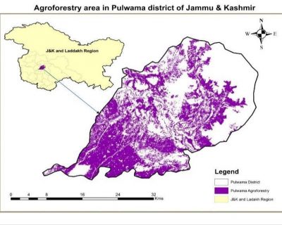
Estimation of agroforestry area of different region of Jammu and Kashmir based on Geospatial techniques (Rizvi, R. H. et al)

